The Crazy Mountains: Montana’s Less-Heralded Alternative to the Tetons
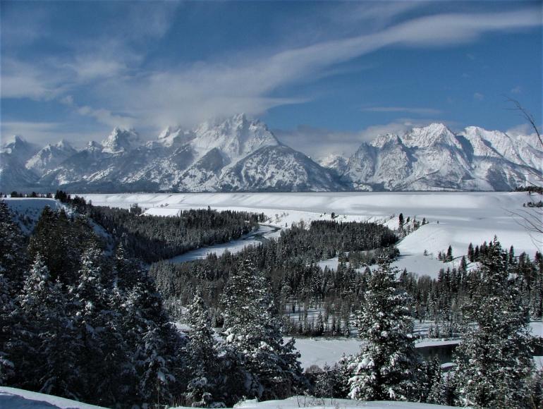
Photo by Robert Schmittou
In recent years, marquee destinations in the Northern Rockies have experienced an unprecedented surge in visitation, particularly during peak operational season. Glacier National Park, for example, tallied almost 3.1 million visitors in 2021, the second-most in park history, which included a record-shattering total of 710,661 for September. Similar patterns were observed in Yellowstone and Grand Teton National Parks, which established all-time, single-month records in July 2021, with approximately 1.08 million and 829,000 visitors, respectively.
Consequently, information on off-the-beaten-path destinations has never been more valuable, especially to solitude-seeking travelers. Fortunately, the Crazy Mountains of south-central Montana offer an excellent alternative, one that rivals the extraordinary vertical relief and symmetrical profile of the iconic Tetons. In both areas, surrounding topography produces lines of sight that span virtually the entire length of their ranges. Indeed, motorists who regularly traverse the I-90 corridor from Billings to Bozeman are privy to perhaps the most breathtaking view visible from an interstate anywhere in the country. On the westbound approach to Big Timber, the broad-shouldered Crazies rise, without foothills, almost 7,000 feet above the valley floor and, for a short distance, loom directly in front of oncoming traffic.
Encompassing an area roughly 30 by 15 miles in size, the Crazies are Montana’s most impressive island range. With 23 summits that exceed 10,000 feet in elevation, the highest of which is Crazy Peak (11,214 feet), the Crazies also are Montana’s third-highest mountain range. Unfortunately, they comprise the state’s most spectacular assemblage of peaks that is not federally protected by wilderness designation, due to the region’s patchwork quilt of private/public land ownership.
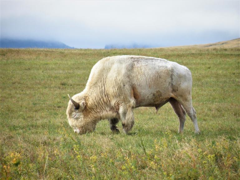
The sacred white buffalo heading north on US 191.
For visitors who prefer to limit their excursions to paved roads, a loop route that follows portions of U.S. Highways 191, 12, 89, and Interstate 90 provides the perfect itinerary for a leisurely day tour and superb views of the Crazies from all directions. Beginning at Big Timber, take US-191 north for 44 miles to Harlowton and, from there, US-12 west for 59 miles to White Sulphur Springs. Then follow US-89 south for 67 miles to its junction with I-90, and the freeway for 27 miles back to Big Timber.
This loop can be shortened by approximately 22 miles, if desired, by taking Montana Highway 294 from its junction with US-12, near Martinsdale, west to its terminus at US-89, just north of Ringling. This option brings travelers closer to the Crazies than US-12, which skirts the northern flanks of the Castle Mountains en route to White Sulphur Springs.
Two areas on the segment of US-89 described above warrant further discussion. Junctions with ranch access roads, located near mile marker 31, create unmarked pullouts that afford the rare opportunity to savor panoramic views of three Montana mountain ranges simultaneously: the Crazies to the east, Bridger Mountains to the west, and Absarokas to the south. Points of access to the Shields River Road, which penetrates the west side of the Crazies, and the Bridger Canyon Road (Montana Highway 86), which connects Wilsall and Bozeman, are located just north of Wilsall.
Bridger Canyon Road, a 31-mile-long scenic drive that is fully paved, can be integrated, with modification to the route described above, or traveled as part of a separate, much shorter loop, one that follows US-89 south to Clyde Park and, from there, Brackett Creek Road west to its junction with Montana 86. Bridger Canyon Road provides excellent views of the Bridger Range and, if traversed from west to east, the Crazies. Motorists should be aware, however, that this route’s starting point in Bozeman is somewhat difficult to find. Views are especially picturesque in autumn, when aspens in the Bridger Range become ablaze with color.
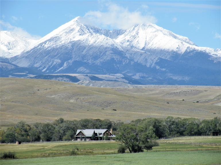
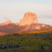
Crazy Peak from US 191 Wouldn't you like to live there?
For visitors who place a premium on solitude, a 40-mile backcountry drive, one that consists primarily of graveled roads, provides views of the northern Crazies that are superior to those afforded by US-191. This route exits US-12 near Two Dot and crosses the Musselshell soon thereafter. At the seven-mile mark, a spur road heads west, then south, toward the base of the Crazy Mountains, thus facilitating unsurpassed views of this rugged range. The main road takes a southerly course past Lebo Lake, then turns due west toward the Crazies and loops around Porcupine Butte, before its final, eastward approach to Melville.
Big Timber Canyon and Cottonwood Creek roads provide access, respectively, to the most heavily utilized trails on the east and west sides of the Crazy Mountains. Big Timber Canyon Road starts 11.2 miles north of Big Timber at its junction with US-191. Follow this gravel road west for approximately 14 miles to Half Moon Campground, where the Big Timber Creek trailhead is located. Cottonwood Creek Road begins roughly 0.5 mile north of Clyde Park and parallels Cottonwood Creek for 12 miles before reaching the Ibex Guard Station junction. The main road continues to the right for another three miles to its conclusion at the Cottonwood Lake trailhead.
One of the most popular destinations in the Crazies, Cottonwood Lake can be approached as an out-and-back day hike, 12 miles in length, or as an overnight backpacking trip. This challenging trail ultimately climbs 2,000 feet to Cottonwood Lake (8,945 feet). Campsites are available at the lake, and fishermen will be delighted to know that it harbors a good population of cutthroat trout. If time permits, Grasshopper Glacier is accessible from Cottonwood Lake via a difficult, but not technical, ascent. Nestled against the north/south crest of the Crazies, Grasshopper Glacier offers excellent views of Crazy Peak and the Big Timber Creek drainage, which is chockful of alpine lakes.
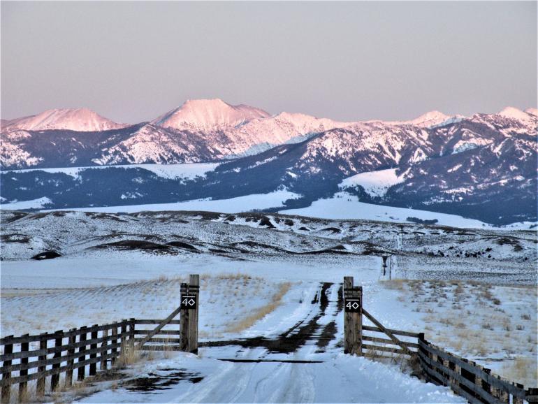
Crazy Mountains from my favorite spot on US 89 mile marker 31.
The Big Timber Creek Trail, which starts at Half Moon Campground, provides access to this densely concentrated group of lakes. A popular route follows the trail west for 2.8 miles to its junction with the Blue Lake Trail and the latter path for 1.2 miles to its terminus at Blue Lake (8,282 feet), which neighbors Granite and Thunder Lakes. From Blue Lake, Druckmiller and Pear Lakes are inviting off-trail destinations, ones closer to the crest of the Crazies. Another option follows Big Timber Creek Trail for 4.2 miles to Twin Lakes and, if desired, another 3.4 miles to Glacier Lake, from which the Sweet Grass Trail takes hikers to points farther north in the Crazies.
The grandeur and rugged topography of this mountain range are self-evident. However, first-time visitors should approach the Crazies with great respect, both for the weather that they generate and the spiritual power with which they are imbued by the Creator. Indeed, the Apsáalooke (Crow) name for this range is Awaxaawippiia, which translates roughly as Treacherous or Ominous Mountains, in recognition of the harsh weather conditions frequently encountered there. Although Crow males commonly underwent vision quests in the Bighorn and Pryor Mountains, Burton Pretty on Top, Sr., states unequivocally that “The Crazy Mountains has always been the holiest of all the Mountains used by our people for fasting and vision quests.” In the pre-reservation period, the Crows also regarded the Crazies as a tribal sanctuary. According to Pretty on Top, “In times of attacks from other tribes that outnumbered us, we would run back to Awa xa ipia for protection. Once we entered into those canyons, the enemy would retreat and leave because they knew this Mountain was our sacred protector.”
Renowned Crow warriors and chiefs, including Medicine Crow and Plenty Coups, received powerful dreams and even prophetic visions during quests undertaken in the Crazies. As a nine-year-old boy, on Crazy Peak, Plenty Coups experienced a vision that provided a template for Crow foreign policy during their turbulent transition from an autonomous people to reservation life. Plenty Coups’ vision foretold the disappearance of bison from the High Plains. In his dream, he also witnessed the destruction of a vast forest, except for one tree inhabited by a chickadee. Yellow Bear, a Crow elder, informed Plenty Coups that the Four Winds, which laid waste to the forest, symbolized the encroaching tide of Euroamerican expansion, and the felled trees represented tribes that fought against the white man. Conversely, Yellow Bear interpreted the “Chickadee’s lodge in that standing tree [as a symbol of the lodges of the Crow nation] pitched in the safety of peaceful relations with white men.” The enduring truth of that vision informed tribal policy for years to come.
Given the strong spiritual and historical connection between the Apsáalooke people and the Crazy Mountains, hikers and backpackers who explore these craggy peaks would be wise to keep one final thought in mind. Should you come across an oval- or U-shaped archeological feature, one consisting of stacked rock walls, approximately four feet long, two feet wide, and one to two feet in height, with an opening to the east, you may be standing on sacred ground, a site consecrated by fasting, prayer and, perhaps, even autosacrifice. In that event, enjoy the spectacular views of the high country but do not disturb the integrity of this vision-quest structure.
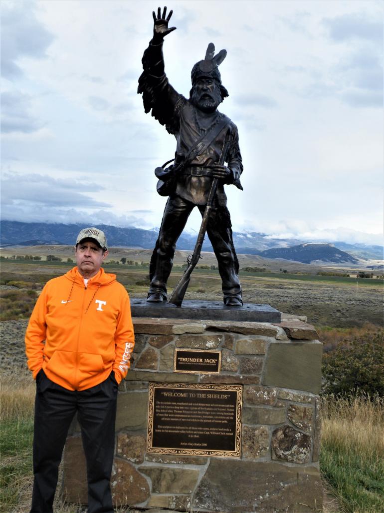
Doug and Thunder Jack with the Crazy Mountains in background.



- Reply
Permalink