Brilliance and Beauty: Celebrating the Gift of a Blackfoot Map
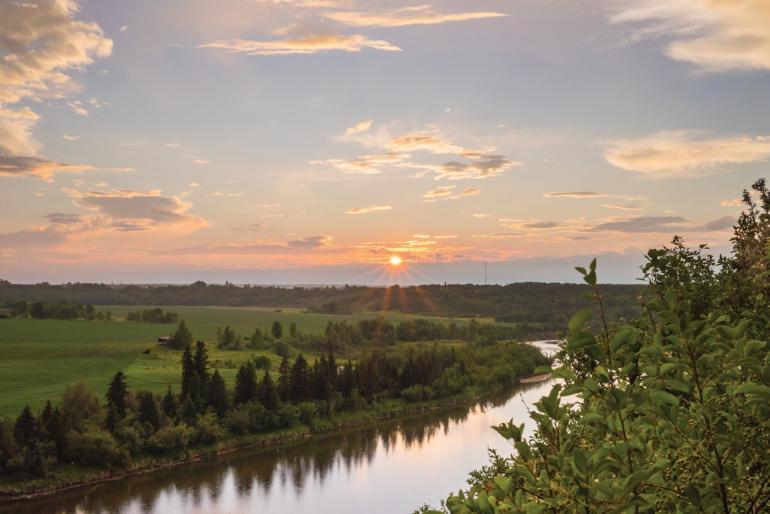
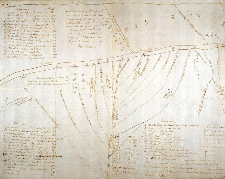
In February of 1801, a Blackfoot Chief named Ako Mic Mi, translated as Feathers, traveled on horseback to the confluence of the Red Deer and Saskatchewan Rivers in present-day Canada to visit the first trading post ever established on the Northern Plains. Having heard that a new arrival sought detailed information about the local area, Ako Mic Mi (sometimes spelled Ac ko mok ki) came to the Chesterfield House that day to share with Hudson Bay surveyor Peter Fidler what Indigenous people had been trading there since time immemorial—relevant and topical knowledge of the world. Because his knowledge came from an oral tradition and he had no handheld map to give to Peter, Feathers instead drew a balanced and centered diagram of lines on the ground and then communicated the details to Fidler using the spoken Blackfoot language and Plains Sign. Fidler copied the lines of the diagram into his journal and then added demographic and geographic footnotes related to him through Feathers’s oral communication.
The final copy of Feathers’s map describes a landscape of over 200,000 square miles and stands out as being the most expansive oral account of a geographic region ever recorded on the continent. Stretching from Oregon to North Dakota, and from Alberta to central Wyoming, the map identifies 14 major tributaries of the Missouri River, from the Milk River in the north to the Bighorn River in the south, and includes the location of prominent island mountain ranges interspersed between the rivers. Also listed in the notes is the estimated number of nights travel between each river, which provides the more specific information needed to make the map relevant for exploration. He estimated that traveling the distance on horse from the Milk River to the Bighorn would take approximately 30 nights, or one moon.
Just as impressive as its scale was the map’s utilitarian design. Its tidy and simple structure provided a reliable context for navigation, and the other descriptive details allowed for a more in-depth understanding of the actual terrain and culture of the region. Feathers’s map emphasized the concept of the Continental Divide by drawing two parallel lines that separate the map from top to bottom, showing the Missouri and its tributaries on one side and the Snake and Columbia Rivers on the other. Then, after marking the lay of the land, Ako Mic Mi filled in the ethnographic details by naming 32 different Tribal communities positioned along the rivers, the number of lodges in each village, and the name of the head chief in each tribe.
Ako Mic Mi’s knowledge and ability to recall it was built upon a sophisticated network of communication that was hundreds of generations in the making. Long before Montana became a state and its modern borders were drawn, Native people recognized the place as a central and pivotal zone unto itself, where the rivers of the earth started and flowed in opposite directions. The state’s broad and diverse landscapes contain vibrant ecosystems that made it a bastion for the Plains Indian way of life. Over the course of the past 13,000 years, the archaeological record shows an ebb and flow of people over time, but the last 2,000 years brought dozens of diverse Tribal nations here, and many stayed and continue to maintain their presence on their homelands.
Prior to when colonial forces began to dramatically shift the populations of people and wildlife in the 19th century, Montana’s Indigenous communities represented a hinterland for some of the largest language families in North America. To the north, the Blackfeet and Cree speak an Algonquin dialect that comes from the Great Lakes. In the east, the Apsáalooke and Lakota have Siouan languages from the Mississippi Valley. Down south, the Shoshone speak a form of Uto-Aztecan, which is centered in Mesoamerica. Out west of the divide, the Bitterroot Salish trace their dialect to the Columbia River and Pacific Coast. Remarkably, the Kootenai language is the only tongue isolated to Montana, although Native people understand their relationships to their homelands as being one of continuity and reciprocity since time immemorial.
Montana’s ancient character as a blessed but at times hostile land has always kept civilization at bay, and that holds true into the 21st century, with the winter of 2022-23 setting records for cold and snow and even wild animals perishing in large numbers. Mesoamerican farming and agricultural traditions that swept across North America never took root in Montana because Native people recognized that Montana is not a place that can be tamed or cajoled; rather it must be embraced and accepted. Ancestors of today’s Apsáalooke nation had successfully grown corn, beans and squash for a short time along the far eastern portion of the Yellowstone River near present-day Glendive. However, the site was abandoned about 500 years ago as the Apsáalooke people moved further east toward the headwaters of the Yellowstone River and became full-time hunter-gatherer-traders. Their collective experience and the wisdom they took from the land is reflected in an old Tribal placename near present-day Springdale—Where the Corn Died.
Along with the extreme climate, Montana’s topography is also distinct from other zones on the Great Plains because its Continental Divide area is diffuse and accessible, making it a thoroughfare for Native peoples both east and west of the divide who ventured across culture zones to hunt, gather and trade. The snowcapped Rocky Mountains connect directly eastward onto a sweeping prairie that is interspersed with clear, cold rivers and bursting with island mountain ranges. These magical and mysterious mountains dot the open plains and harbor essential lodgepole pine trees as well as diverse edible and medicinal plants, fresh water, chert rock quarries, winter campgrounds, ceremonial areas, and rendezvous sites. All these blessed resources are not available on the eastern plains of Colorado, Kansas, or Nebraska. North and South Dakota, Canada and Wyoming all fall short of the dynamic place we know of as Montana. The Apsáalooke chief Sore Belly expressed a similar sentiment when he was quoted in the 1830s: “The Crow Country is in exactly the right place. Any direction you go from here is worse. In the north the winters are long and cold. In the south it is too hot and not much water. To the west there are no buffalo and all the people eat fish and pick bones from their teeth. Far to the east the water is warm and muddy, and our dogs won’t drink it. Here in the Crow Country, we have the best of everything. High mountains with snowy peaks, cold clear water, good grasslands with many buffalo, elk and deer, and lots of good wintering sites. The Creator put the Crow Country in the exact right spot.”
Since time immemorial, the tribes of Montana lived a sustainable way of life based on hunting, gathering and trading with each other throughout a seasonal cycle of movement. Feathers’s map from February of 1801 showed the location of the tribes’ wintering campsites, but all those Tribal communities would move from those locations along the rivers during the springtime when flooding, mosquitoes and grizzly bears gave people good reasons to move to higher ground and to nearby rendezvous sites to harvest plants and trade with their neighbors. This ancient lifestyle of Tribal communities walking seasonal rounds existed for millennia before horses, and created a culture of consistent and beneficial interaction that allowed Native people to share ceremonies, music and dance traditions, hunting and gathering strategies, ancient star stories, and a myriad of other cultural innovations. This age-old cosmopolitan interaction eventually spawned one of the world’s great languages, Plains Sign Language. The world’s only non-colonial lingua franca, Plains Sign Language connected the communication network that provided Feathers with the extensive knowledge he had in 1801, but this subtle and profound form of communication was virtually invisible to non-Indians who did not speak it.
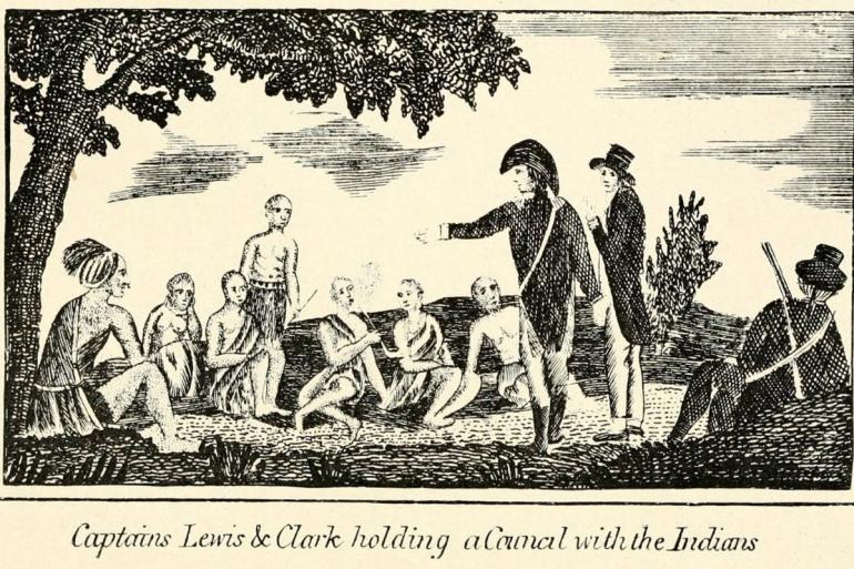
Peter Fidler sent his drawing of Feathers’s map to London in 1801 so that it could be incorporated into the most up-to-date map of the American continent at the time, but because cartographers of the day had no way to include the demographic information and were likely confused by the map’s lack of cardinal directions, most of the major concepts were lost in translation. An updated map was completed in 1802 and sent back to America just in time to make it into the hands of Thomas Jefferson, who passed it along to Meriwether Lewis and Willam Clark in 1804.



Leave a Comment Here