The National Bison Range: Montana’s Other “Crown Jewel”
The National Bison Range: Montana’s Other “Crown Jewel”
The National Bison Range (NBR) is one of 21 National Wildlife Refuges/Management Districts in the state of Montana. Its picturesque 18,500 acres are located in the southern part of the Flathead Reservation, north of Missoula. Teddy Roosevelt signed into existence on May 23, 1908, as an effort to protect the American Bison from extinction. However, its true, though somewhat checkered history, goes back further than that.
It was actually in the late 1800s when “Latati,” (Little Falcon Robe), returned home to the Flathead Reservation from the eastern Montana plains with a small herd of bison calves, which eventually became the nucleus of the founding herd. Apart from a brief outline of the history on the NBR web site, the Confederated Salish and Kootenai Tribes have produced an excellent, 30-min documentary of the Range called “In the Spirit of Atatice.” It is available for free viewing on their web site.

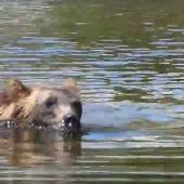
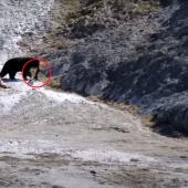
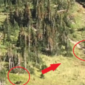
While the NBR is known for its 250 – 300 bison, it is so much more. It is “a diverse ecosystem of grasslands, Douglas fir and ponderosa pine forests, riparian areas and ponds. The Range is one of the last intact publicly-owned intermountain native grasslands in the U.S. In addition to herds of bison, it supports populations of Rocky Mountain elk, mule deer, white-tailed deer, pronghorn, and bighorn sheep as well as coyotes, mountain lions, bears, bobcat and over 200 species of birds”

There are two main road loops through the NBR. The lower one, Prairie Drive, runs along the lower reaches of the Range. It is a two-way 14-mile roundtrip that allows wildlife viewing along the flats east above Mission Creek and then south. It is open year-round (weather permitting). The other, longer loop is Red Sleep Mountain Drive. This is a 19-mile, one-way loop road that gains 2,000 feet, and there are many switchbacks and 10% grades along the drive. It connects with Prairie Drive at the bottom of its course. It is generally open from mid-May, often opening on Mother’s Day, until mid-October – again, weather permitting. This drive takes one through the heart of the Refuge. It is a slow road, so allow 2 hours for the complete loop. It peaks out near the summit of Red Sleep Mountain, affording impressive views of the Mission Mountains to the east, as well as a Geology Display about Glacier Lake Missoula. Hee is an NBR map.

May is when life on the Bison Range comes alive. There are large blooms of arrowleaf balsamroot, that turn whole hillsides into seas of yellow, as well as many other wildflowers, such as larkspur and bitterroot. The grasses are a vibrant green, and the bison will have recently calved, so there are babies in the herd to view and enjoy. The elk and deer begin to grow their new year’s antlers, and so are in full velvet. While I visit the Bison Range year-round for both its scenic beauty, wildlife, and exceptional photography opportunities, I always eagerly await that weekend in May when the upper road opens. It is a splendid time to visit.

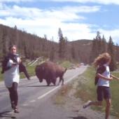
Visitors should stay in their vehicles while driving these loops, especially when wildlife is nearby. There are also some short trails, such as the 1-mile long paved, accessible, Nature Trail down low, along Mission Creek and around several ponds. It passes through stands of large cottonwoods and dense junipers and provides excellent habitat for cavity-nesting birds, as well as turtles and frogs. The other two trails are located higher up on the Red Sleep Mountain Drive. The 1/2-mile roundtrip Bitterroot Trail is relatively flat but rocky. As its names suggest, it is a great place to see the Montana State Flower, the bitterroot, in bloom in late June. The other, High Point Trail, is a 1-mile roundtrip walk that leads to the highest point of the Refuge (4,885 feet above sea level). This trail is often shared by Bighorn Sheep.

Finally, the Range has a charming day-use/picnic area, located among the junipers near the Visitor’s Center. It provides numerous tables and grills for family BBQs, as well as a couple of larger, covered areas for group gatherings. As a bonus – there are often elk in and around the picnic area. Two bull elk, in particular, nicknamed Henry and Oscar by the staff, like to call the picnic area home. Please exercise caution and respect if they are there during your next visit.

Next time you are in the vicinity, say on Hwy 93 in Ravalli, or further north at the Charlo turnoff, you owe it to yourself and family to swing by our beautiful National Bison Range. Spend a couple of relaxing hours with the bison and other wildlife in our “other crown jewel”! You’ll undoubtedly be glad you did.
Happy Trails!
Doug Stevens – the Graytrekker.

Leave a Comment Here