Get To Know Deer Lodge County
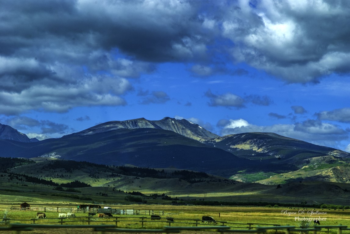
One of the nine original counties at Montana’s birth, Deer Lodge County was one of two counties lying almost entirely west of the Continental Divide. Like Missoula County, Deer Lodge County predates Montana. As Missoula was originally created by Washington Territory, Deer Lodge was one of Idaho Territory’s counties. At that time, it covered 5,525 square miles, almost as large as Beaverhead County, today’s largest in area. In time, Silver Bow, Granite, and Powell Counties all took land away from the original, leaving Deer Lodge County as Montana’s second smallest in area. Only Silver Bow County is smaller. On a side note, I feel obliged to note that while we generally think of the Divide as running north/south, it cuts today’s Deer Lodge County in half east to west. The county’s southern line, adjoining Beaverhead County, is the middle of the Big Hole River. With the creation of Powell County in 1901, Deer Lodge County was left with an area of 742 square miles of which 4.7 is water. The 2020 U.S. Census counted 9,421 residents, down from a 1960 high of 18,640. The current population puts the county at 23rd place of Montana’s 56. The county number is 30.
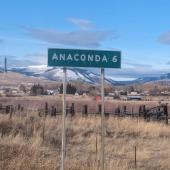
Anaconda
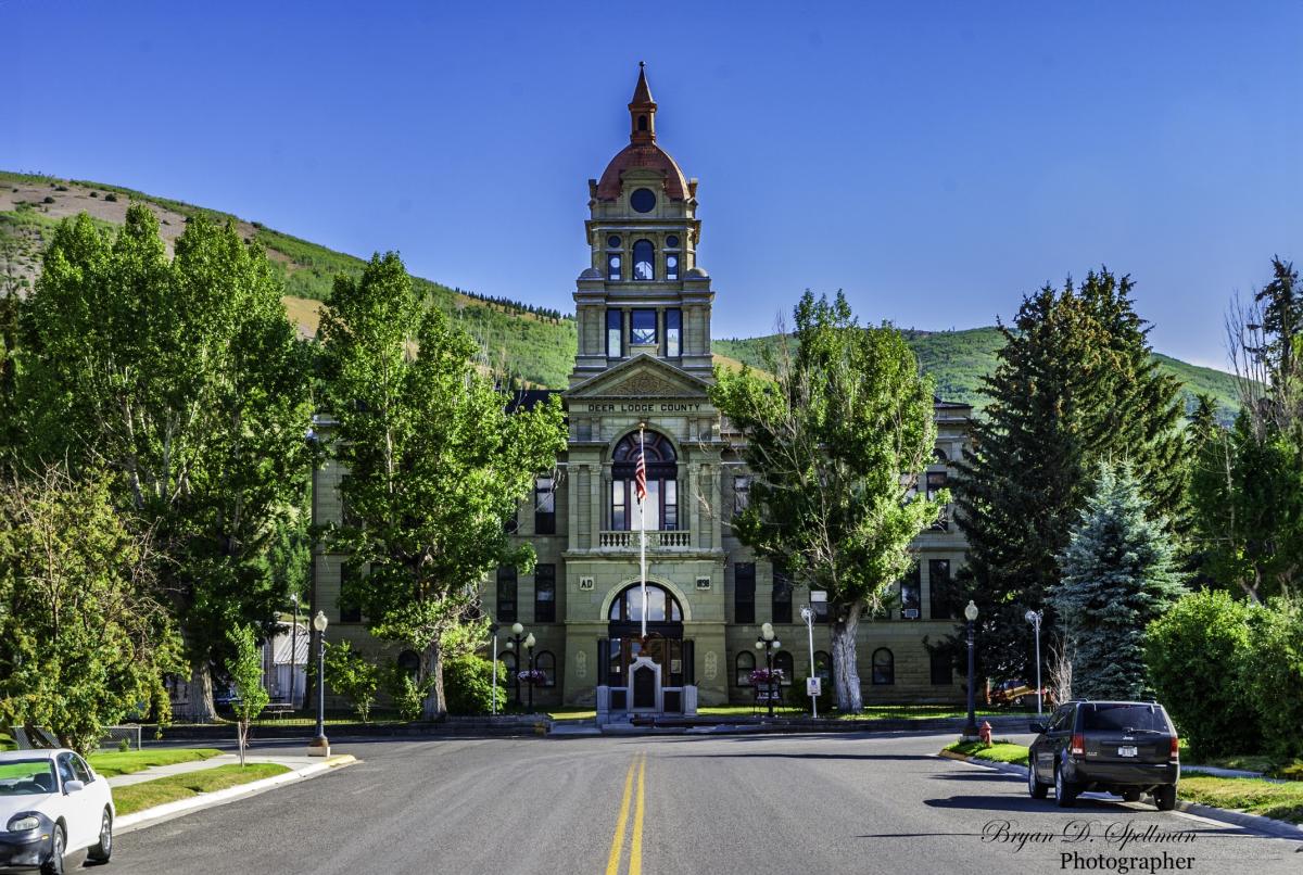
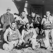
Today, the city of Anaconda and Deer Lodge County are consolidated political entities. The two merged in 1977, one of two such entities in Montana. (The other being Butte-Silver Bow.) But while Deer Lodge County predates even Montana Territory, Anaconda became seat only in 1896. Prior to that, the original seat was Silver Bow, which is now located in Silver Bow County, then Deer Lodge which has been the seat of Powell County since 1901. Marcus Daly, usually considered to be the “father” of Anaconda, was not terribly concerned with his town being a mere county seat. No, in his mind, Anaconda should be the capital of the new state. Two elections were held, the first in 1892 and the second in 1894. Seven communities sought the honor in 1892, with the top two contenders facing off in 1894. In the 1894 contest, every county west of the Divide voted for Anaconda, as did Cascade and Gallatin, but the final vote count showed Helena won by a mere 2,000 votes. I have oft maintained that the impressive Deer Lodge County Court House was designed to substitute for the state capitol—at least in Daly’s vision. Walk up Main Street and look at that building. Tell me that’s not a state capitol. Step inside and take in the lobby, the staircases and the dome. This is one beautiful building.
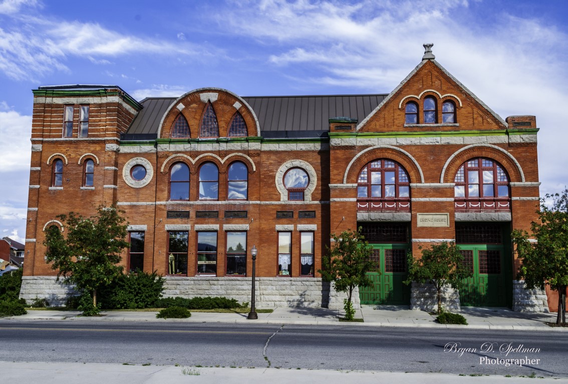
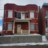
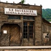
But then, many of Anaconda’s buildings are beautiful. This is a city I love to walk, camera in hand. Whether the original city hall, the Butte Anaconda and Pacific Railroad headquarters building, the Washoe theatre, the Club Moderne, and any one of the many churches around town—the city is a visual feast for a photographer.
Other Communities
While Anaconda is the only city in Deer Lodge County, there are several small communities scattered around the county. Galen and Warm Springs, both north of Anaconda on Interstate 90, are communities built around hospitals. Galen, founded in 1912 and named for the Greek/Roman physician Claudius Galen, sought to cure tuberculosis by exposure to clear, cold mountain air. Ironic that it was downstream from the smokestack and toxic air emanating from Anaconda’s smelters. A 2002 MSU News article points out that the real reason for building Galen was fear of contagion. The thought in the early 1900s was that tuberculosis was contagious, and the best way to protect the citizenry was to isolate the infected. The State Tuberculosis Sanitarium finally closed in 1993, long after medicine found more reasonable ways to treat the disease and its victims. Today the facility is part of the Montana State Hospital.
A few miles south of Galen, Warm Springs is home to the main campus of the Montana State Hospital. Built in 1877, the facility remains Montana’s only psychiatric hospital. The hospital has a total of 270 beds, including group home and forensic facility beds. The “community” includes a post office and a bar (currently closed).
About six miles east of Anaconda, Opportunity was designed as a garden-spot retirement community for the men who worked Anaconda’s smelters and their families. It forms the core of Brad Tyer’s 2013 book Opportunity, Montana: Big Copper, Bad Water, and the Burial of an American Landscape. Having read the Amazon.com sample pages, I can’t wait to finish the book. (Yes, I ordered my own copy.)
Two other names that appear on the map east of Anaconda are Crackerville and Gregson. Now, I’ve lived in Montana most of my life and have driven between Missoula and Butte more times than I can count. My research for this article is the first time I ever came across Crackerville, but at one time it was an actual town—hard to say when, though. The website Roadside Thoughts mentions Crackerville and even points to a site that lists nearby towns as found in an 1895 Rand McNally Atlas. Alas, that site indicates that it has no information on Crackerville but does mention Gregson being two miles away. Gregson I’ve heard of. There is even an I-90 exit for Gregson, which takes you to Fairmont Hot Springs. For what it’s worth, Montana Secondary 441 runs between I-90 at Gregson and Montana 1 at Opportunity. Mapquest shows it as “Crackerville Road.”
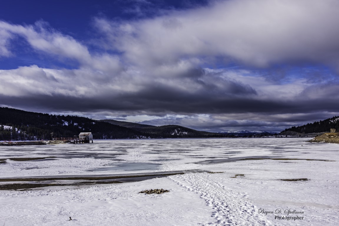
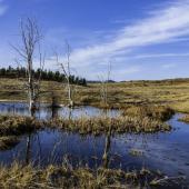
West of Anaconda, two ghost towns lie near the line with Granite County. Southern Cross is all that’s left of a mining camp that at one time had 500 residents. It overlooks Georgetown Lake from 7,000 feet above sea level. The lake, split almost in half between Deer Lodge and Granite Counties, looks like a normal mountain lake, but is an artificial reservoir formed when Flint Creek was dammed to provide power to the mines of Philipsburg. The resulting reservoir covered the historic town of Georgetown, although a few buildings and businesses along the southern shore keep Georgetown active as a place name.
Recreation and Parks
Where Deer Lodge County was once an industrial appendage to the mines of Butte, today recreation is most likely bringing visitors to the area. South and east of Anaconda, Mount Haggin is home to not only a 56,000-acre Wildlife Management Area (WMA) with opportunities for hiking, climbing and mountaineering, but in the winter Nordic skiing enthusiasts head to the area for over 11 kilometers of groomed trails, on a course that Mile High Nordic calls “strenuous.” In my younger years, I loved skiing at Mount Haggin, and I concur, the trails are strenuous.
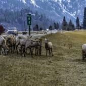
Fishermen and water enthusiasts should visit Georgetown Lake. Rainbow and brook trout abound, as do kokanee salmon. Ice fishing is popular during the winter months, and shoreline or boat casting when the water is open.
Perhaps one of the more distinctive golf courses in Montana is the Old Works course designed by Jack Nicklaus on land reclaimed from the smelter operations of years past. The 18-hole, par 72 course has a yardage of 7,705 and offers views of the mountains surrounding the area.
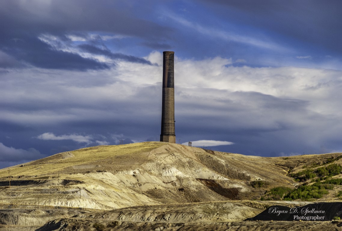
Anaconda is also home to a Montana State Park—but you cannot visit it. Visible from at least twenty miles away, the centerpiece of the Anaconda Smokestack State Park stands 585 feet tall and is one of the tallest free-standing brick structures in the world. It is so large you could put the Washington Monument inside it and have room left over. Completed in 1919, the stack served the smelter until 1980 when the smelter closed and then was demolished. Public outcry kept the stack standing and today it is one of Montana’s State Parks. But the land around the stack is so toxic visitors are kept at a distance.


Leave a Comment Here